
User's Guide
UIC previously published a user guide for the Rights-of-Way as Habitat Working Group’s Pollinator Habitat Scorecard. This guide provides a quick reference to the assessment tool for new users.
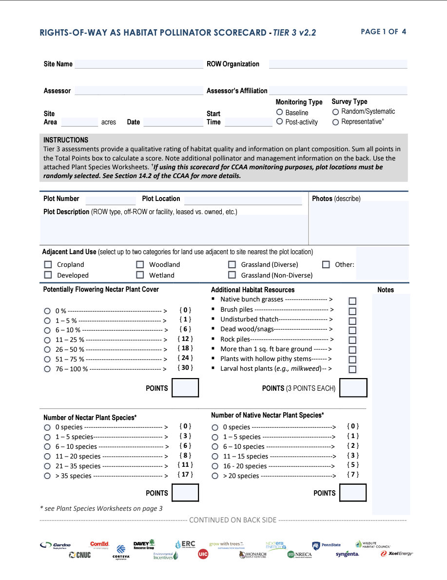
Tier 3 Scorecard
This scorecard is intended for advanced assessors who are capable of identifying most plants to species-level.

Geospatial Habitat Database
UIC, in partnership with The Field Museum, maintains the Geospatial Habitat Database. This database is an online repository of habitat and monitoring data compiled by Rights-of-Way as Habitat Working Group partners.

Calculation Worksheet: Number of Plots
This guide introduces several methods for determining the optimal number of sampling plots based on sampling objective(s).
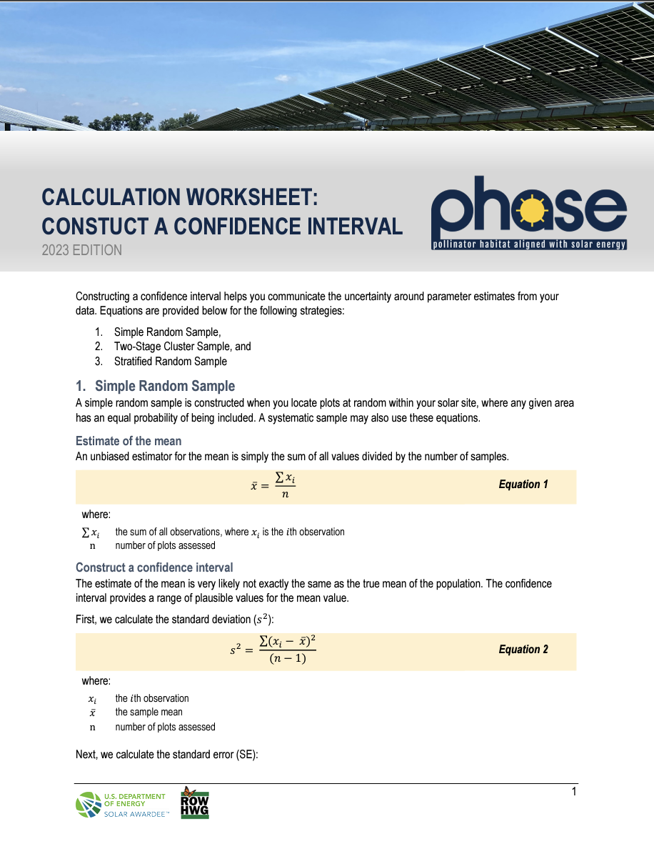
Calculation Worksheet: Construct a Confidence Interval
This guide introduces several methods for determining the optimal number of sampling plots based on sampling objective(s).