


Habitat Assessment Tools – All Resources
Welcome to the Habitat Assessment Tools, your comprehensive resource for evaluating and monitoring habitat in the context of conservation and land management at photovoltaic facilities. Whether you’re a beginner looking to get started or an experienced assessor seeking advanced tools, we’ve got you covered. Explore the menu below to access a wealth of information and tools tailored to your needs.

User’s Guide
UIC previously published a user guide for the Rights-of-Way as Habitat Working Group’s Pollinator Habitat Scorecard. This guide provides a quick reference to the assessment tool for new users.
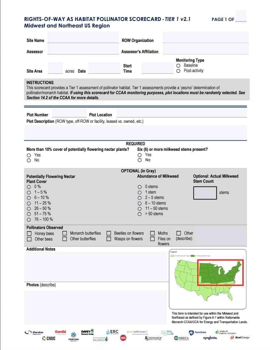
Tier 1 Scorecard Midwest/Northeast Calculator
This scorecard is intended for use by anyone, with minimal training or plant identification skills required. The scorecard clearly delineates required and optional monitoring fields per the Monarch CCAA.
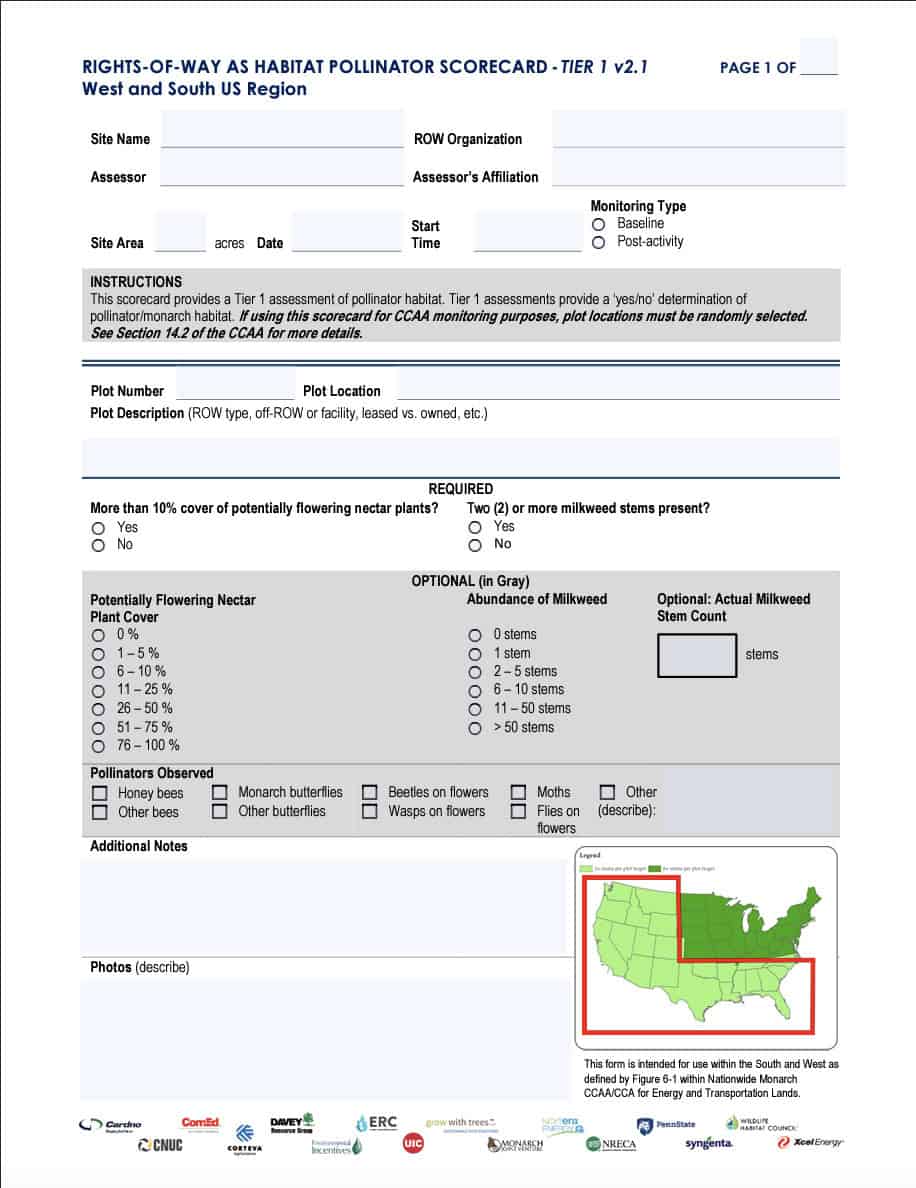
Tier 1 Scorecard West/South Calculator
This scorecard is intended for use by anyone, with minimal training or plant identification skills required. The scorecard clearly delineates required and optional monitoring fields per the Monarch CCAA.
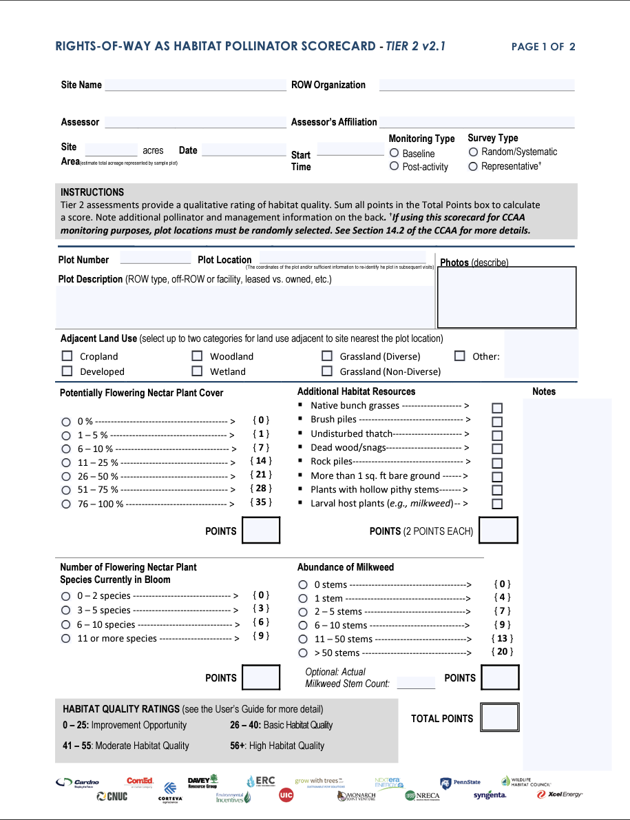
Tier 2 Scorecard
This scorecard is intended for use by most assessors. Some skill level is required to identify percent plant cover, flowering plants in bloom, habitat resources, and management threats and opportunities.
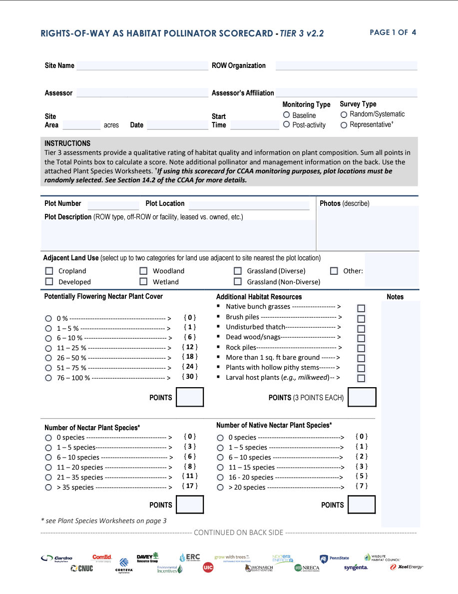
Tier 3 Scorecard
This scorecard is intended for advanced assessors who are capable of identifying most plants to species-level.
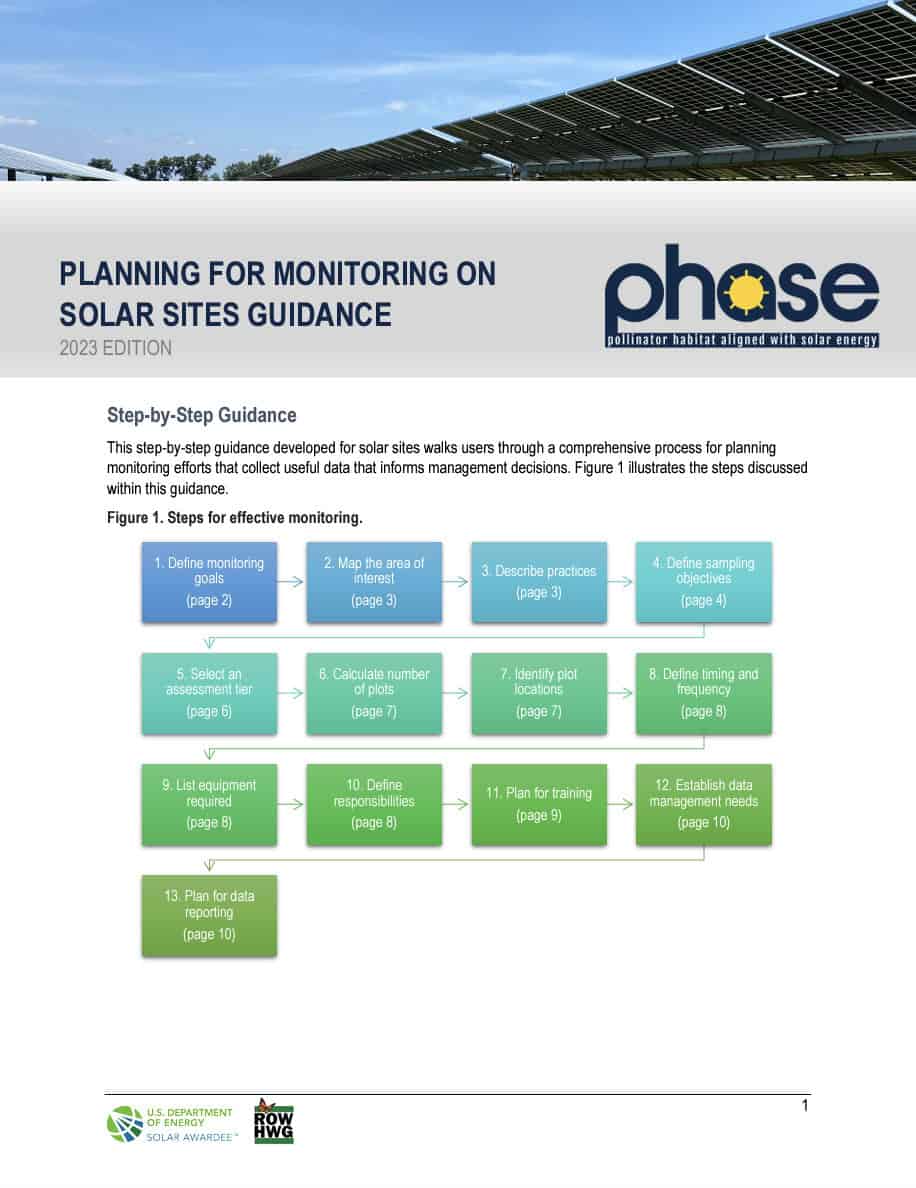
Planning for Monitoring Guide
This systematic guide designed for solar sites takes users through a thorough procedure to strategically plan monitoring initiatives, ensuring the collection of valuable data that serves as a foundation for informed management decisions.

Example Monitoring Plans
Users may find the monitoring plan template helpful for preparing monitoring plans.

Strategies to Reduce Monitoring Costs
While guidance provided can support a robust monitoring program, users may experience limitations in resources or abilities. This guidance helps solar sites identify ways to reduce monitoring costs by offering less time intensive or costly alternatives for amending monitoring plans.

Strategies for Distributing Plots
Determining where to sample in a way that reduces or eliminates bias is an important aspect of monitoring. This guidance presents several approaches to distributing plots across a site.

Geospatial Habitat Database
UIC, in partnership with The Field Museum, maintains the Geospatial Habitat Database. This database is an online repository of habitat and monitoring data compiled by Rights-of-Way as Habitat Working Group partners.

Calculation Worksheet: Number of Plots
This guide introduces several methods for determining the optimal number of sampling plots based on sampling objective(s).
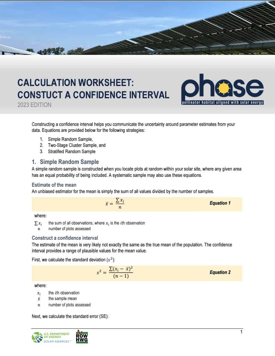
Calculation Worksheet: Construct a Confidence Interval
This guide introduces several methods for determining the optimal number of sampling plots based on sampling objective(s).

Development of the PHASE website was funded through the U.S. Department of Energy’s Office of Energy Efficiency and Renewable Energy (EERE) under the Solar Energy Technologies Office Award Number DE-EE0009371. The views expressed herein do not necessarily represent the views of the U.S.Department of Energy or the United States Government.