


Habitat Assessment Tools – Advanced
Welcome to the Habitat Assessment Tools, your comprehensive resource for evaluating and monitoring habitat in the context of conservation and land management at photovoltaic facilities. Whether you’re a beginner looking to get started or an experienced assessor seeking advanced tools, we’ve got you covered. Explore the menu below to access a wealth of information and tools tailored to your needs.

User’s Guide
UIC previously published a user guide for the Rights-of-Way as Habitat Working Group’s Pollinator Habitat Scorecard. This guide provides a quick reference to the assessment tool for new users.
Tier 3 Scorecard
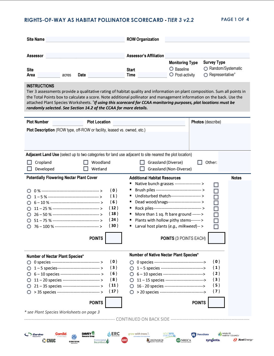
This scorecard is intended for advanced assessors who are capable of identifying most plants to species-level.

Geospatial Habitat Database
UIC, in partnership with The Field Museum, maintains the Geospatial Habitat Database. This database is an online repository of habitat and monitoring data compiled by Rights-of-Way as Habitat Working Group partners.

Calculation Worksheet: Number of Plots
This guide introduces several methods for determining the optimal number of sampling plots based on sampling objective(s).
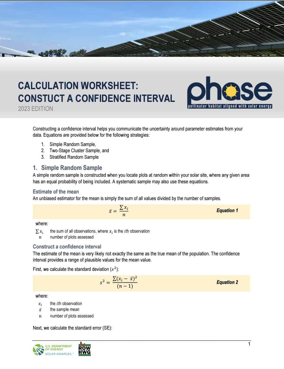
Calculation Worksheet: Construct a Confidence Interval
This guide introduces several methods for determining the optimal number of sampling plots based on sampling objective(s).

Development of the PHASE website was funded through the U.S. Department of Energy’s Office of Energy Efficiency and Renewable Energy (EERE) under the Solar Energy Technologies Office Award Number DE-EE0009371. The views expressed herein do not necessarily represent the views of the U.S.Department of Energy or the United States Government.